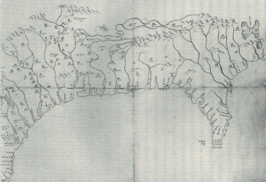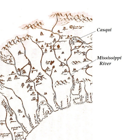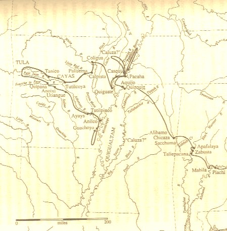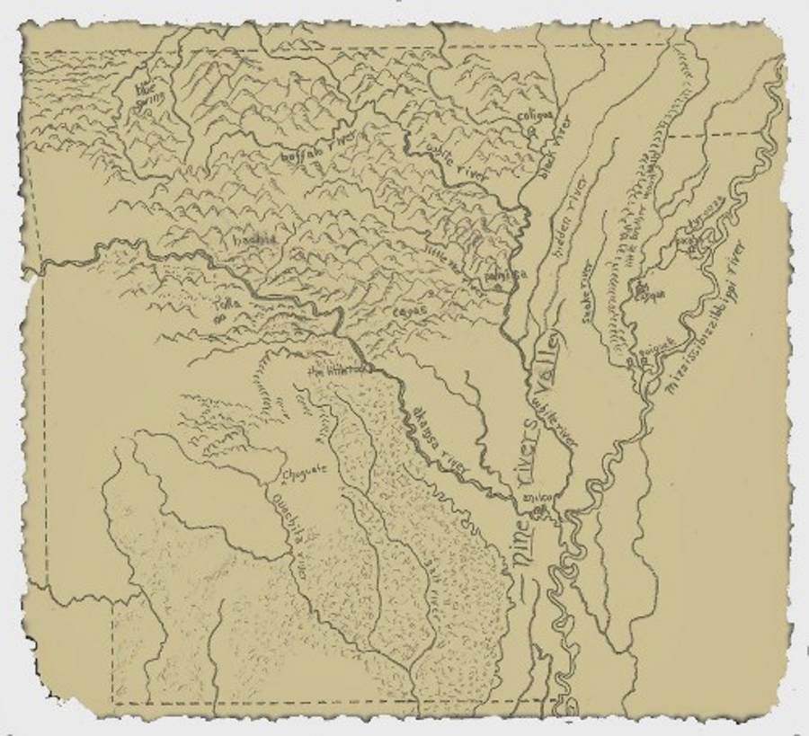
Earliest known map (ca. 1544) to illustrate the interior of North America was based on the De Soto Expedition. It is housed in the “General Archive of the Indies” in Seville, Spain.
Maps:

Enlarge area of the De Soto Map showing many of the towns that disappeared completely from the Arkansas-Mississippi River Valley and history.
~~~
~~~
Journals:
The Holy Crusades fought in the Middle East beginning in 1096 AD afforded the Europeans nations a great deal of experience in the finer details of planning, financing, equipping, and transporting large armed forces by sea for the purpose of conquering distant lands and converting or enslaving its people. After the Crusades ended, the Spanish refocused their sights, expertises, and forces of trained conquistadors on the newly discovered Americas. Courage and dedication in the service of the Crusades had long become a means for all ranks of men to gain notoriety, nobility, and wealth. Hernando De Soto was such a man. He rose through the ranks during several successful expeditions into Central and South America. De Soto had amassed so much gold that he was considered one of the richest men in the world at the time he petitioned the King of Spain. He requested permission to lead an expedition into the unexplored wilderness of North America, what was then called “La Florida.”
De Soto was given the right to govern all the land that he could conquer in the new world. He would also receive a portion of all its riches and trade goods. Three Spanish ships were outfitted with 618 men, over 300 horses, and all the necessities needed for an extended military campaign. They landed on the western coast of Florida in 1539. The highly trained army fought their way through seven states to reach the Mississippi River two years later in May of 1541. Among the expedition were three men who’s journals would survive to be translated into a modern text.
The journals all contain daily informative and descriptive entries of their encounters, but none more so than what they witnessed from the eastern shore of the Mississippi River.
Journal of Rodrigo Rangel:
Many of the conquistadors said that this river was a larger river than the Danube. On the other bank of the river, up to seven thousand Indians gathered to defend the crossing and up to two hundred canoes, with shields, which were may made of cane joined together, so strong and so tightly sewn that a crossbow would scarcely pierce them.
Journal of Luys Hernandez De Biedma:
We decided to make four large piraguas, so that each one of them would be able to carry sixty or seventy men and five or six horses. It took us twenty-seven or twenty-eight days to make these piraguas. During this time the Indians each day at hour of three in the afternoon placed themselves in two hundred and fifty canoes that they had there, very large and well shielded and drew near the other shore where we were with a great yell. They shot all the arrows that they could and return to the other bank.
Journal of a Gentleman From Elvas:
The next day, the chief came with two hundred canoes full of Indians with their bows and arrows, painted with red ocher and having great plumes of white and many colored feathers on either side of the canoes) and holding shields in their hands with which they covered the paddlers, while the warriors were standing from prow to stern with their bows and arrows in their hands. The canoes in which the cacique came had an awning spread in the stern and the chief was seated under the canopy. From where he controlled and gave orders to the other men.
Those canoes were very pleasing to see, for they were very large and well built; together with the awnings, the plumes of feathers, the shields, and the banners, and the many men in them, they had the appearance of a beautiful fleet of galleys.
The three journals plus a fourth account, La Florida by Garcilaso de la Vega, “The Inca” based on interviews of several survivors of the failed expedition, are complied along with numerous related documents into a thick two-volume set. For a unique perspective on early American history check out The De Soto Chronicles The Expedition of Hernando de Soto to North America in 1539-1543 Volume I & II.
“This book is entertaining, educational, and well worth reading. An amazing strong yet tender journey, stories like this stay with readers forever.”
Bonnie Turner Face the Winter Naked and Down the Memory Hole
,,,,,,,,,,,,,,,,,,,,,,,,,,,,,,,,,,,,,,,,,,,,,,,,,,,,,,,,,,,,,,,,,,,,,,,,,,,,,,,,,,,,,,,,,,,,,,,,,,,,,,,,,,,,,,,,,,,,,,,,,,,,,,,,,,,,,,,,,,,,,,,,
Home 1)Books 2)Reviews/Interviews 3)Excerpt from Storykeeper 4)Maps/Journals 5)News/Events 6)Sites/Resources 7)Bio 8)Sounds 9)Contact
,,,,,,,,,,,,,,,,,,,,,,,,,,,,,,,,,,,,,,,,,,,,,,,,,,,,,,,,,,,,,,,,,,,,,,,,,,,,,,,,,,,,,,,,,,,,,,,,,,,,,,,,,,,,,,,,,,,,,,,,,,,,,,,,,,,,,,,,,,,,,,,,


